AI Powered RadX solution helps in Fast Tracking Road Asset Management & Road Safety Survey
RadX helps in analyzing the images obtained from videos taken from cameras mounted on Network Survey Vehicles and detects Road objects linked to Road Asset Management. It helps in generating dynamic reports that covers the aspects such as Pavement Surface Properties (Type & Category, Carriageway, Shoulder, Topography, Geometry, Drain etc.,) and Pavement Condition properties (Surface distress like Cracks, potholes, edge break etc.,).
Following RadX features helps in fast tracking Road Asset Management reporting:
Ability to define dynamic report template for each project scope
Ability to define dynamic labels and tags for each project scope linked to required Road survey objects, so that it takes care of future needs
Ability to copy the labels from previous projects, to save new project setup time
Ability to identify common features and applying to all the images/entire network stretch
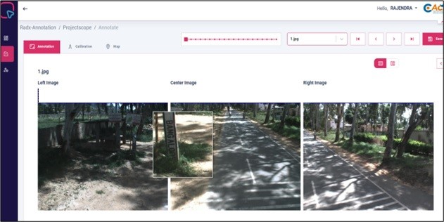
Ability to view and annotate the images in a systematic/user friendly way
Ability to view all three images (front view and two side views) simultaneously and identify road featuresto define dynamic report template for each project scope
Ability to run thru the images at desired frequency and provide Zoomable view
Ability to do calibration and thus help in measuring size of various Road objects
Ability to define type of cracks and measure their size using calibration
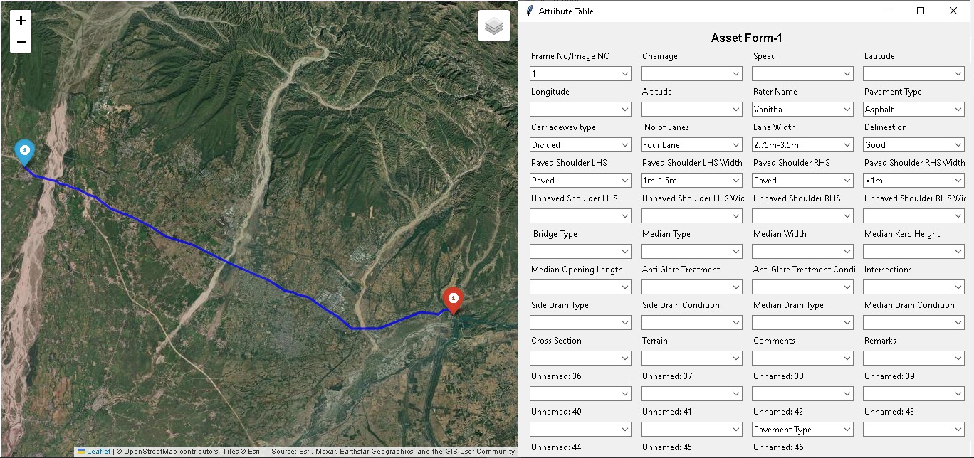
Ability to view the Satellite Map at the desired location on the network stretch
Ability to provide elastic co-ordinates at required intervals on the stretch for third party verification
Ability to generate & download report as per user demand from any where
Ability to audit all events happened for a project scope
Application View – Sample Annotation
The detailed annotations can be made for the road and additional annotations are possible. The data can also be stored for reference and comparison.
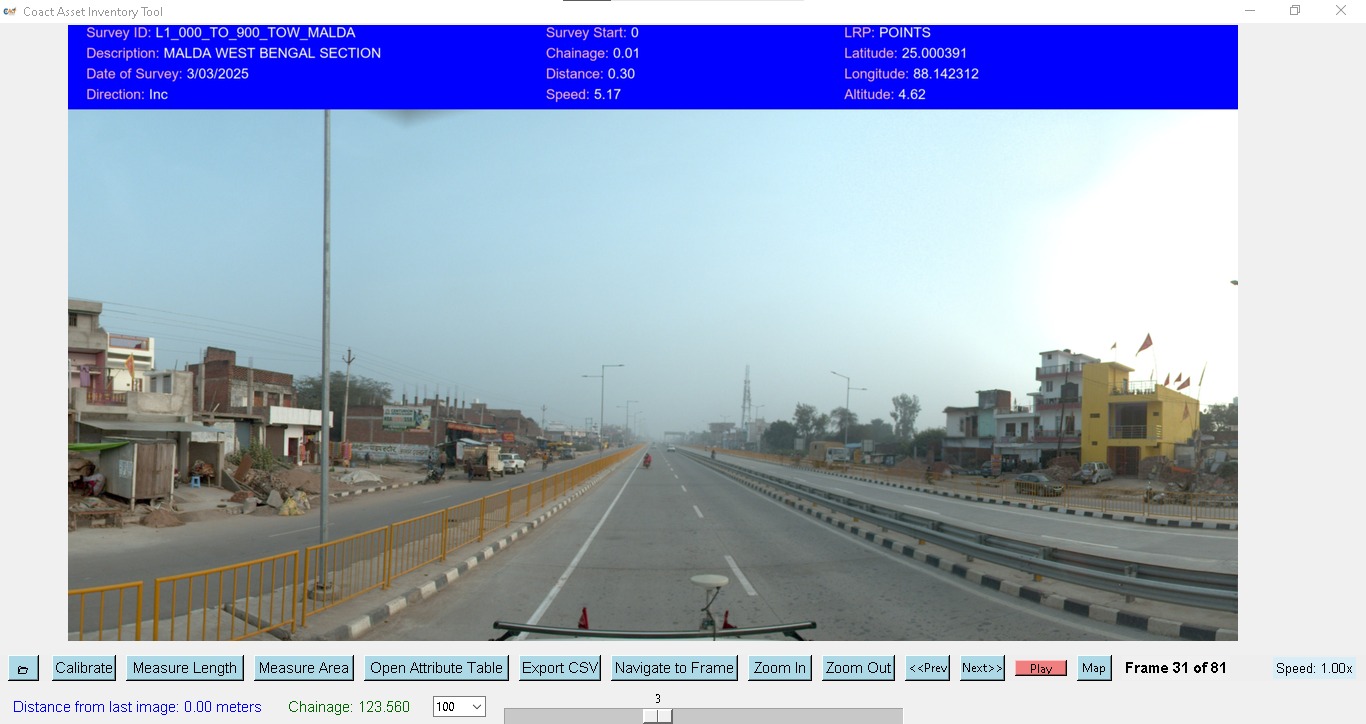
AUTOMATED ASSET INVENTORY TOOL
For Image Browsing & Rating: “Effortlessly browse through survey images frame by frame, with the ability to record and rate asset conditions by simply checking the corresponding attributes in the data panel.”For GPS & Map View: “Every surveyed asset is geo-tagged with precise GPS coordinates, allowing users to visualize and track asset locations in real time directly on an interactive map.”
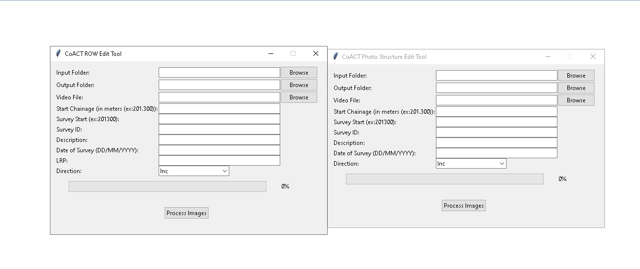
AUTOMATED DISTRESS & ROW VIDEO PROCESSING TOOL
The Automated Distress and ROW Video Processing Tool streamlines the entire survey workflow by automatically processing both road distress and main carriage survey videos — eliminating the need for manual data entry by seamlessly loading all GPS data, chainage, survey details, and directional information. Whether capturing pavement distress conditions or right-of-way encroachments, the tool intelligently organizes and generates accurate, structured output files for both survey types with a single click, saving time and ensuring data consistency across all survey operations.
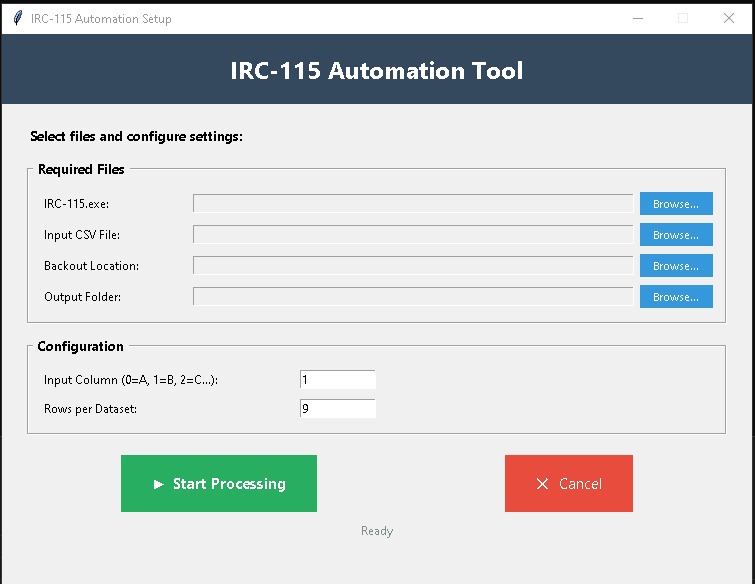
IRC-115 Automation Tool
The IRC-115 Automation Tool simplifies and accelerates data processing by eliminating manual intervention. Users simply configure the input CSV file, specify the target column, define how many rows form a single dataset, and let the tool handle the rest. Once initiated, the tool automatically segments the data into structured blocks, extracts the relevant column values, and silently runs each dataset through the IRC-115 engine in the background. Results are saved directly to the designated output folder, while a backup of the original data is preserved for security. Fast, reliable, and fully automated — built for efficiency at every step.
Contact
Address : B-113, Armsburg MySpace, Pipeline Road, Jeedimetla, Hyderabad, Telangana, 500067
Email : sre@coactsolutions.in, coactsolution@gmail.com
Contact Number : +91 9700001188 / 9176660236